


Chattanooga is a unique town in a valley between the rolling green mountains of the South and the Tennessee River. This makes it a prime location for beautiful scenery and fun ways to get outdoors. As I grew up in Chattanooga, there was one hike that my family and I kept returning to. It has everything you could want, from scenic views to swimming, a waterfall, and much more.
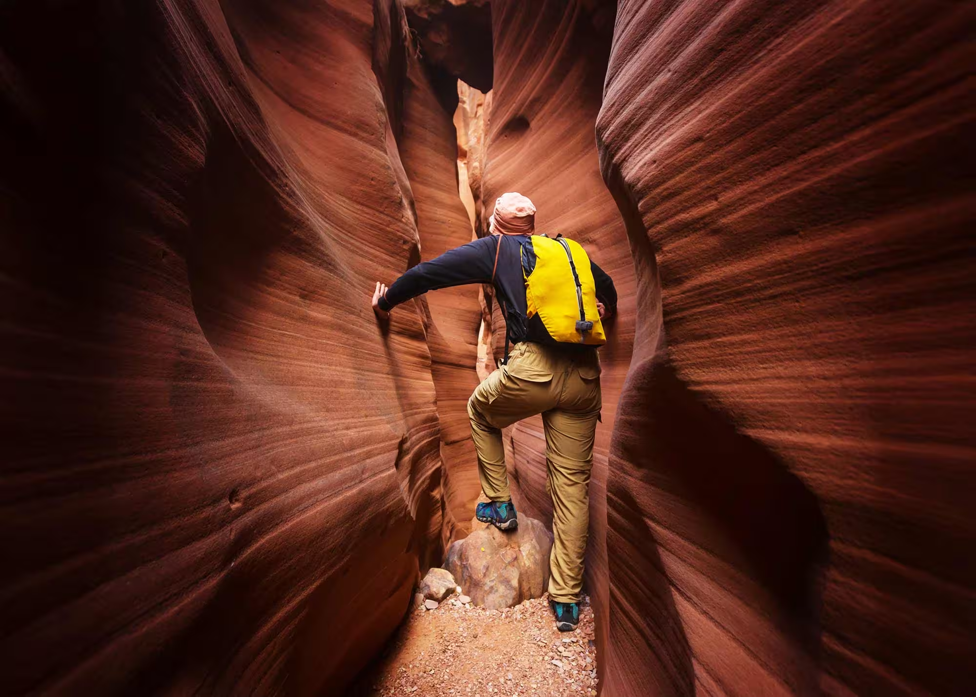
The hike from Signal Point follows the Cumberland Trail along the ridge line of Signal Mountain. Located only 15-20 minutes from downtown Chattanooga, this is an excellent place to go when you want to conveniently and easily experience all that Chattanooga has to offer in one place. However, keep in mind that sections of this hike are close to the mountain edge, and it can get pretty steep, so it may be better for small children or others who may not want that.
Signal Mountain: A Historical And Scenic Gem
Signal Mountain itself is a historical location within the city. It has a rich history spanning Native American habitation, European settlement, and various periods of development. Before European settlers arrived in the area, Signal Mountain and the surrounding region were inhabited by Native American tribes, including the Cherokee. These tribes used the mountain as a landmark and for its strategic vantage point to observe the surrounding terrain. The first European settlers arrived in Chattanooga during the late 18th century. With its commanding view of the Tennessee River and the surrounding landscape, Signal Mountain was named for its use by Native American tribes to send smoke signals.
During the Civil War, Signal Mountain was a lookout point for both Confederate and Union forces. The mountain’s elevation and panoramic views made it an essential location for observing troop movements and potential threats. Both sides sought to control Signal Mountain for its strategic advantages. Now, the town of Signal Mountain is known for its friendly atmosphere and close-knit neighborhoods. It has become a great place to hang out with various events, festivals, and local organizations, contributing to its unique character.
Getting Started: Signal Point Parking Lot
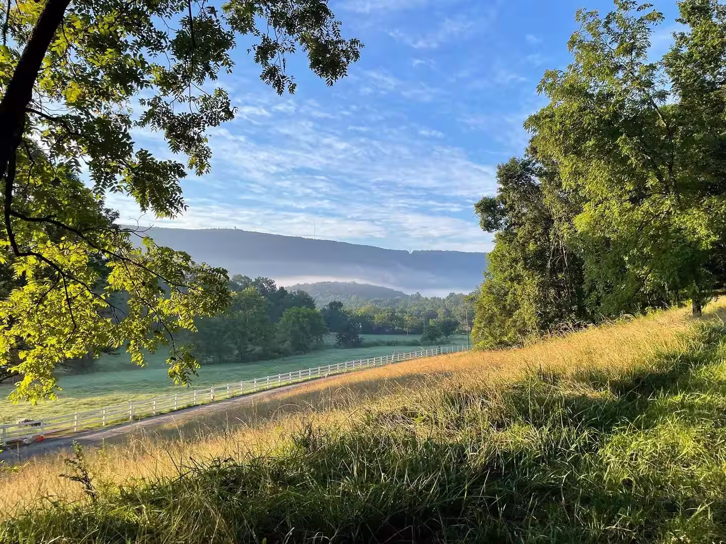
The best way to do this hike is to start at Signal Point. Coming from downtown Chattanooga, you take a windy road up the mountain to get here. Almost immediately, when you reach the top, you will turn into a neighborhood area instead of going into the town. Once you reach the parking lot of Signal Point, there is a short walk down to the first overlook before you even get on the trail. This overlook provides panoramic views of the Tennessee River, Moccasin Bend, and downtown Chattanooga.
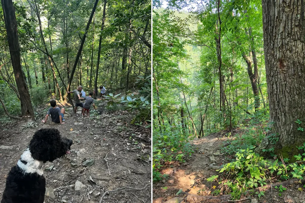
Ascending The Ridge: The Trail Begins
Once you have had your fill of the views, you continue onto the trail, which starts with a section of stairs. The first part of the hike is the steepest; however, from there on out, it is relatively flat, with a few minor ups and downs as you traverse the ridge. Along the hike, you will spot a lot of cool boulders that are fun and easy to climb on for a new perspective or a good place to rest.

Julia Falls Overlook
Julia Falls Overlook: A Glimpse Of The River
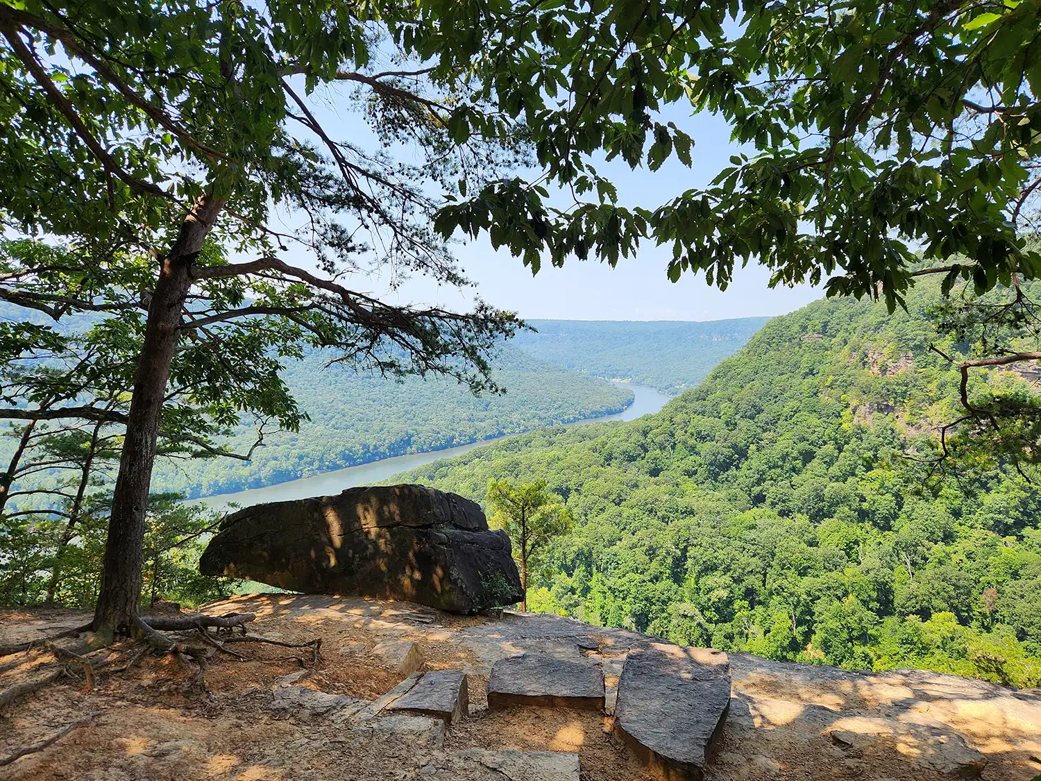
The next popular spot you will come across is the Julia Falls overlook. It is a part of the trail that opens up to views of the Tennessee River as it winds through the valley. As you continue down the trail, you will start going more into the mountain itself rather than hiking near the ridge line.
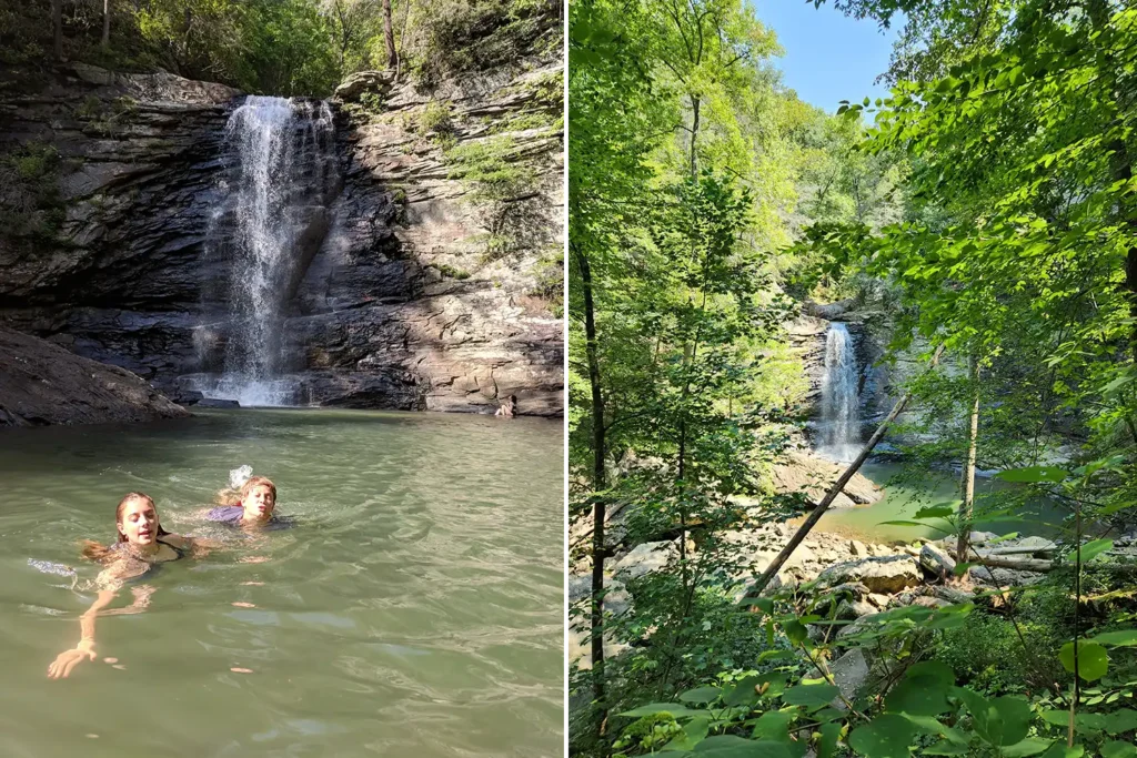
Rainbow Falls, Signal Mountain, TN
Rainbow Falls: A Refreshing Oasis
About half a mile down the trail on the left is Rainbow Falls. It is a great place to stop, hang out, and even swim in the blue hole. The route to the falls is the most challenging section of the hike as it is a lot steeper than the rest of the trail. Recently, they added ropes and things to hold on to down the slope, which makes it safer. The hike down to the waterfall is challenging, but it is definitely worth it. The waterfall is about 50 feet tall and cascades into a pool perfect for swimming when the water level is high. The stream then continues down the mountain and can be fun to rock-hop along.
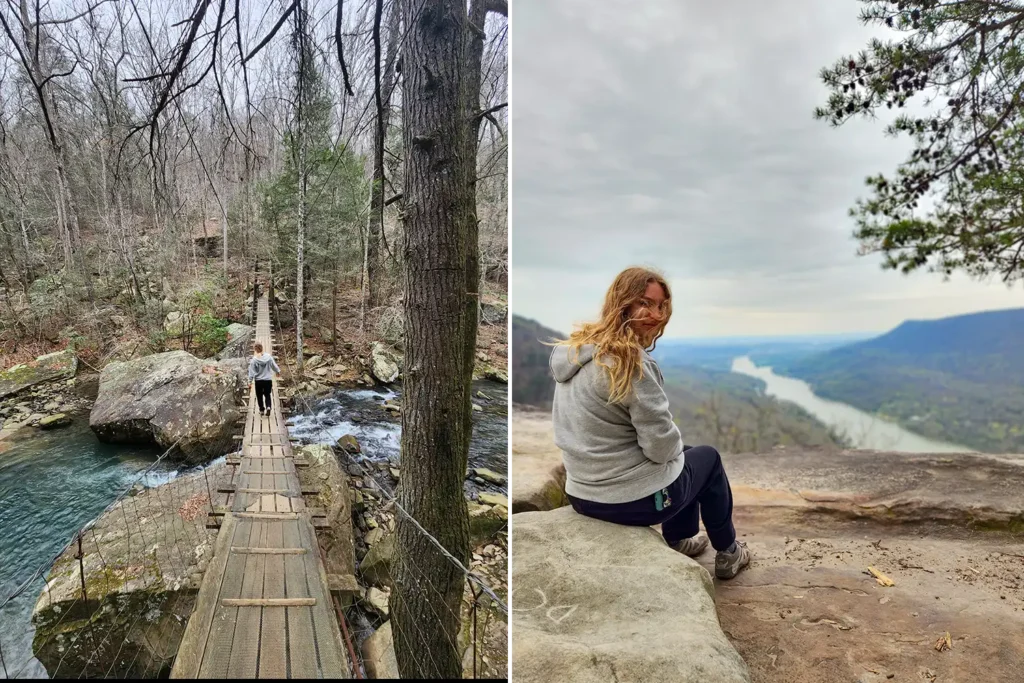
Edward’s Point Overlook: A Stunning Panorama
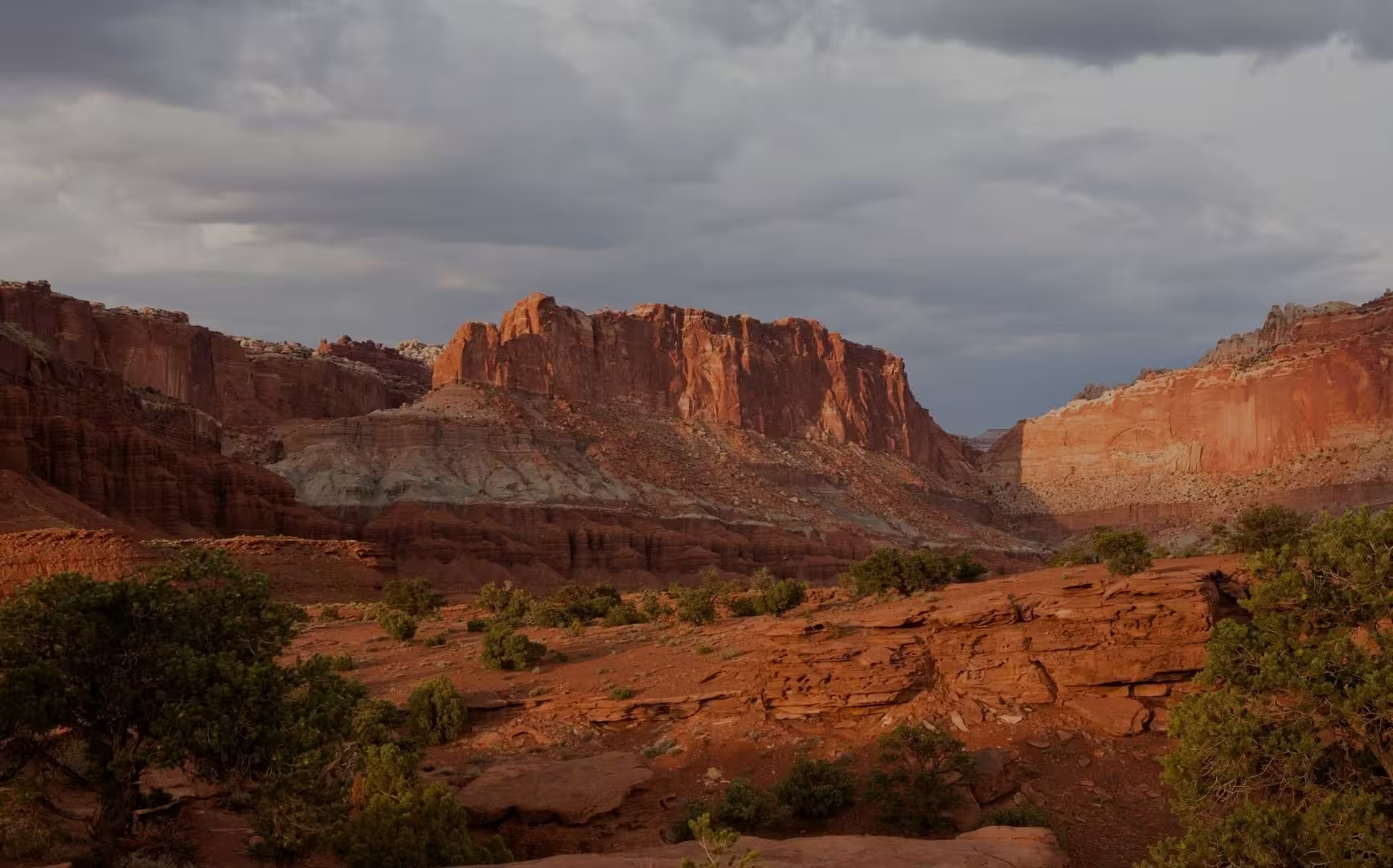
If you decide not to go down to the waterfall, or if you want to keep hiking afterward, don’t worry because there are another 1.6 miles of trail before you reach Edwards Point. The trail occasionally intersects with and crosses various streams, and is beautiful to follow through the trees. You will come across different rock walls, some that people climb on, others with intriguing caves dug into them. Once you reach Edwards Point Overlook, you will have another open view of the Tennessee River Gorge, facing back toward Chattanooga. Edward’s Point is a dramatic overlook that provides stunning views of the surrounding valleys.
Year-Round Beauty: Enjoy The Trail In Every Season
The total hike from Signal Point to Edwards Point is about 2.5 miles one way and 5 miles total. Along the way, you will encounter many views of the Tennessee River from atop Signal Mountain and hike through trees, boulders, and interesting rock formations. Throughout the hike, there are spots where you encounter the water either in the form of the stream tumbling down towards the river or as Rainbow Falls. All of these things together make this hike continuously stimulating, exciting, and exceptionally beautiful. It provides an excellent opportunity to experience the wilderness surrounding Chattanooga while still being easily accessible. It is beautiful in all seasons: in fall, when the trees are vibrantly colored; in spring, when everything is coming alive; in winter, when the trees are bare, but the views are accentuated; and in summer, when it is good to get in the water to splash around and cool off.
Popular Posts


Adventure stays here